
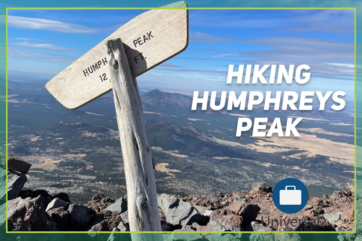
Hiking Humphreys Peak: The Highest Point in Arizona- What to Expect
Here’s my first-hand guide to help make hiking Humphreys Peak more enjoyable.
What is the Highest Point in Arizona?
The highest point in Arizona is Mount Humphreys, or Humphreys peak.
Humphreys Peak is one of Northern Arizona’s most recognizable landmarks. At an astounding 12,633 ft., this landmark is an adventurer’s paradise among flagstaffs san francisco peaks! This out and back trail offers a difficult, but rewarding experience in the state known for the grand canyon.
How hard is it to hike Humphreys Peak? What Class is it?
Humphreys peak is rated at a difficult rating for most climbers. While not technical in anyway (the highest class on the hike to the top is a class 2 scramble), the altitude and cold can get to you if you’re not expecting it. In addition, freak storms can sweep in and cause dangerous conditions at the summit with little warning. It pays to come prepared when hiking Humphreys peak!
Planning for the Trail: Packing
Every good hike needs to start somewhere, and this is no different. When planning for Humphreys peak trail, there are 3 things to keep in mind: when you are going to start the hike, what time of year you are going to be doing it during, and your own experience level.
Hiking Humphreys Peak is recommended anywhere from May to September, but depending on how much (or little) snow is on the peak, it can be completed as late as November.
Summer Months Pack List:
The trail is easily marked and not hard to follow, so getting lost should be no issue. A cold weather jacket, even during the summer, is highly recommended, as at 12,000 feet, the wind can chill you to your bones! Bring plenty of water, and consider bringing a snack for the top, before you head back down the mountain. In addition, a rain jacket is encouraged, as Arizona during the summer months experiences downpours of extreme strength called “Monsoons”. Finally, bring hiking poles, especially if you are inexperienced!
Winter/Spring/Fall Months Pack List:
Packing for the colder months is essentially the same, but with more emphasis on colder gear. Gloves, hats, and jackets are required to complete this hike, especially if the temperature in flagstaff is at 45 degrees or below. Start early!
Getting to Humphreys Peak Trailhead
Now that you’re prepared for the trail, how do you get there? Navigating to the peak is pretty simple. Simple navigate to the Arizona snowbowl with your GPS, and head up N snow bowl road to the parking lot. While a forest road, this is a paved road, so you don’t need any special gear to get up it, besides tire chains in the winter. From there, finding the trailhead can be somewhat confusing, as there are plenty of other hiking trails in the area. Once you’re in the parking lot area, the trailhead and associated parking is the first turn to the left in the snow bowl area. The trail is marked “Humphreys trail”, but is right near the Arizona trail as well.
Hiking the Peak: The Meadow

Once you’ve arrived, the first part of the mountain you encounter is a nice beautiful meadow. This is where the trail begins This rolling, open meadow is what you will be returning to once you come back down the mountain, and sometimes, deer and other wildlife graze in the meadow, so be on watch!
Kachina Peaks Wilderness:
Once you leave the meadow, you enter the Kachina Peaks wilderness. Although inside the larger Coconino national forest, this is it’s own, separate area.
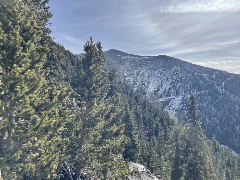
This area is where all of the hike on the trail will be taking place, and is defined by lush, northern forests, that remind you more of Colorado, or the pacific northwest, more than Arizona. This area is a strenuous hike, as you aren’t really greeted to the views that you will get when you get above the tree line, as you are hiking up slight inclines and going through switchbacks. Pine trees, birch, and all sorts of unusual flora await you in the wilderness.
Reaching the Tree line
Once you reach about 11,000 feet in altitude, the tree line starts to go away. From here on, you are met with amazing views of the trail, humphrey’s peak itself and the entirety of the san Francisco peaks.
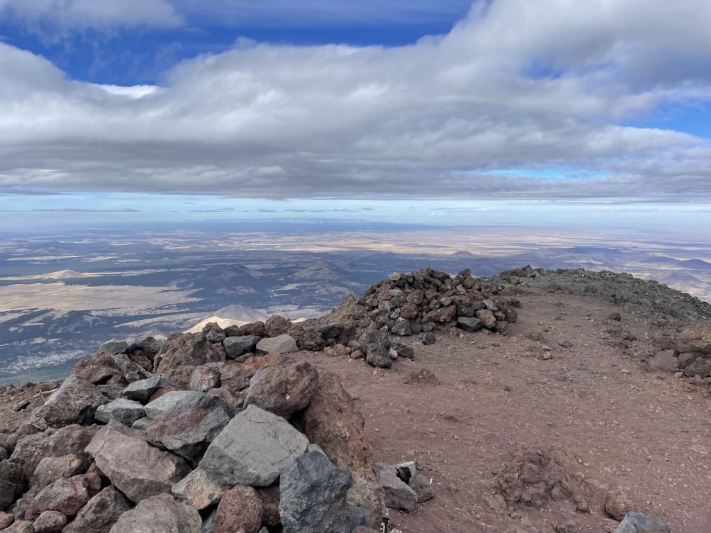
Ridgeline Climbing
Once you peak over and glance into the Locket meadow onto the ridge, you follow the trail up onto what becomes the first of many false summits. This area is exposed, long, and strenuous because of the altitude, so take it easy to ensure you don’t get altitude sickness.